Hevigere buien door klimaatverandering
31-05-2017 12:00 - KNMI - Relevant 28-05-2017
Storm Forecast valid: Mon 29 May 2017 07:00 to Tue 30 May 2017 06:00UTC
29-05-2017 07:00 - Estofex - Relevant 29-05-2017/30-05-2017

Storm Forecast valid: Sun 28 May 2017 06:00 to Mon 29 May 2017 06:00UTC
27-05-2017 20:01 - Estofex - Relevant 28-05-2017/29-05-2017

Storm Forecast valid: Sat 27 May 2017 06:00 to Sun 28 May 2017 06:00UTC
27-05-2017 06:51 - Estofex - Relevant 27-05-2017/28-05-2017
.png)
Storm Forecast valid: Thu 02 Mar 2017 06:00 to Fri 03 Mar 2017 06:00 UTC
02-03-2017 00:54 - Estofex - Relevant 02-03-2017/03-03-2017

Storm Forecast valid: Mon 27 Feb 2017 06:00 to Tue 28 Feb 2017 06:00UTC
26-02-2017 23:53 - Estofex - Relevant 27-02-2017/28-02-2017

Foto windmeting
23-02-2017 12:00 - Skywarn NL waarnemer - Relevant 23-02-2017

Aa en Maas: Alert voor storm
23-02-2017 12:00 - Waterschappen - Relevant 23-02-2017
Storm Forecast Valid: Thu 23 Feb 2017 06:00 to Fri 24 Feb 2017 06:00 UTC
23-02-2017 00:12 - Estofex - Relevant 23-02-2017/24-02-2017

Animaties luchtdruk/wind berekeningen
22-02-2017 23:29 - Skywarn NL forum - Relevant 23-02-2017
Sneeuw op 12 en 13 januari 2017
13-01-2017 12:00 - KNMI - Relevant 12-01-2017/13-01-2017
Liveblog Januaristorm
12-01-2017 12:00 - Rijkswaterstaat - Relevant 13-01-2017
Haringvlietbrug (A29) dicht na ongeluk in de mist
30-12-2016 06:31 - Rijkswaterstaat - Relevant 30-12-2016
Animaties van de berekeningen voor luchtdruk en wind
19-11-2016 13:00 - Skywarn NL forum - Relevant 20-11-2016
Storm Forecast valid Sun 02 Oct 2016 06:00 to Mon 03 Oct 2016 06:00UTC
01-10-2016 17:34 - Estofex - Relevant 02-10-2016/03-10-2016

Foto van de hagel in de Walsberg (Deurne)
16-09-2016 12:00 - Weerwoord - Relevant 15-09-2016/16-09-2016
Wateroverlast mei - juni 2016
05-09-2016 12:00 - Waterschappen - Relevant 27-05-2016/30-06-2016
Schade nabij Nijkerk door vermoedelijke downburst
04-09-2016 20:00 - Weerwoord - Relevant 04-09-2016
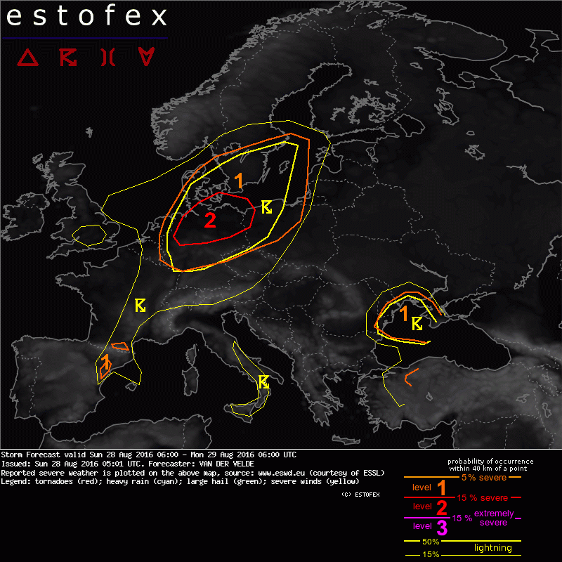
Storm Forecast valid: Sun 28 Aug 2016 06:00 to Mon 29 Aug 2016 06:00UTC
28-08-2016 05:01 - Estofex - Relevant 28-08-2016/29-08-2016
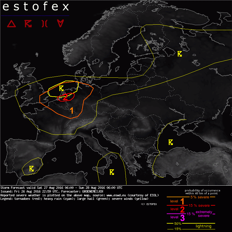
Storm Forecast valid: Sat 27 Aug 2016 06:00 to Sun 28 Aug 2016 06:00UTC
26-08-2016 12:00 - Estofex - Relevant 27-08-2016/28-08-2016