Windhoos Vorden 21 augustus 2016 1755 Leo van Zantvoort
21-08-2016 22:00 - YouTube - Relevant 21-08-2016

Foto waterhoos over een van de randmeren
21-08-2016 12:00 - Weerwoord - Relevant 21-08-2016
Op die dag detecteerde IDRA een tornado bij Ameide
15-08-2016 14:40 - Weerwoord - Relevant 10-09-2011
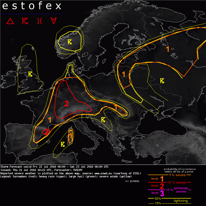
Storm Forecast valid: Fri 22 Jul 2016 06:00 to Sat 23 Jul 2016 06:00 UTC
21-07-2016 18:22 - Estofex - Relevant 22-07-2016/23-07-2016
Onweersbuien op 20 juli 2016
21-07-2016 12:00 - KNMI - Relevant 20-07-2016
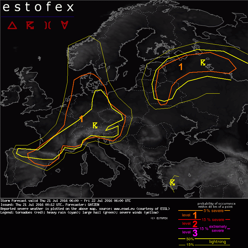
Storm Forecast valid: Thu 21 Jul 2016 06:00 to Fri 22 Jul 2016 06:00 UTC
21-07-2016 00:12 - Estofex - Relevant 21-07-2016/22-07-2016
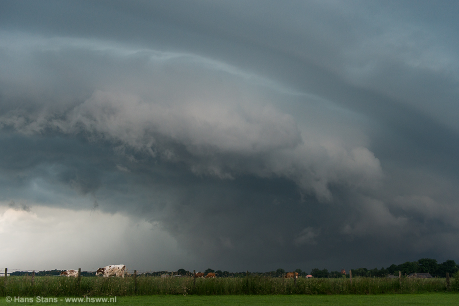
Downburst, schade 4daagsefeesten Nijmegen
21-07-2016 00:07 - Weerwoord - Relevant 20-07-2016
Storm Forecast valid: Wed 20 Jul 2016 06:00 to Thu 21 Jul 2016 06:00UTC
19-07-2016 22:52 - Estofex - Relevant 20-07-2016/21-07-2016

Waterhoos op het IJsselmeer
13-07-2016 12:00 - YouTube - Relevant 13-07-2016

Topic met foto's van waterhozen
13-07-2016 09:16 - Weerwoord - Relevant 13-07-2016
Mesoscale Discussion: Valid: Sun 10 Jul 2016 14:00 to Mon 11 Jul 2016 00
10-07-2016 13:51 - Estofex - Relevant 10-07-2016

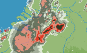
Zware onweersbuien over ZO-Nederland
02-07-2016 00:00 - Hans' Weerweb - Relevant 22-06-2016/23-06-2016
Zware onweersbuien op 22 en 23 juni vol extremen
24-06-2016 12:00 - KNMI - Relevant 22-06-2016/24-06-2016
... nog wat meer video's
24-06-2016 12:00 - Weerwoord - Relevant 23-06-2016
De dag na hagelstenen als tennisballen
24-06-2016 12:00 - YouTube - Relevant 23-06-2016

Miljoenenschade in Zuidoost-Brabant na noodweer met extreem grote hagelstenen
24-06-2016 12:00 - YouTube - Relevant 23-06-2016

Een overzicht met veel hagel- en schadefoto's
24-06-2016 01:13 - Weerwoord - Relevant 23-06-2016
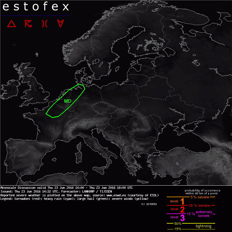
Mesoscale Discussion valid: Thu 23 Jun 2016 14:00 to Thu 23 Jun 2016 18:
23-06-2016 14:32 - Estofex - Relevant 23-06-2016
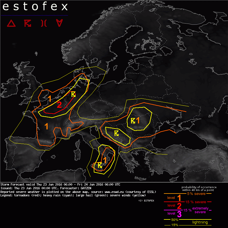
Storm Forecast valid: Thu 23 Jun 2016 06:00 to Fri 24 Jun 2016 06:00UTC
23-06-2016 00:00 - Estofex - Relevant 23-06-2016/24-06-2016
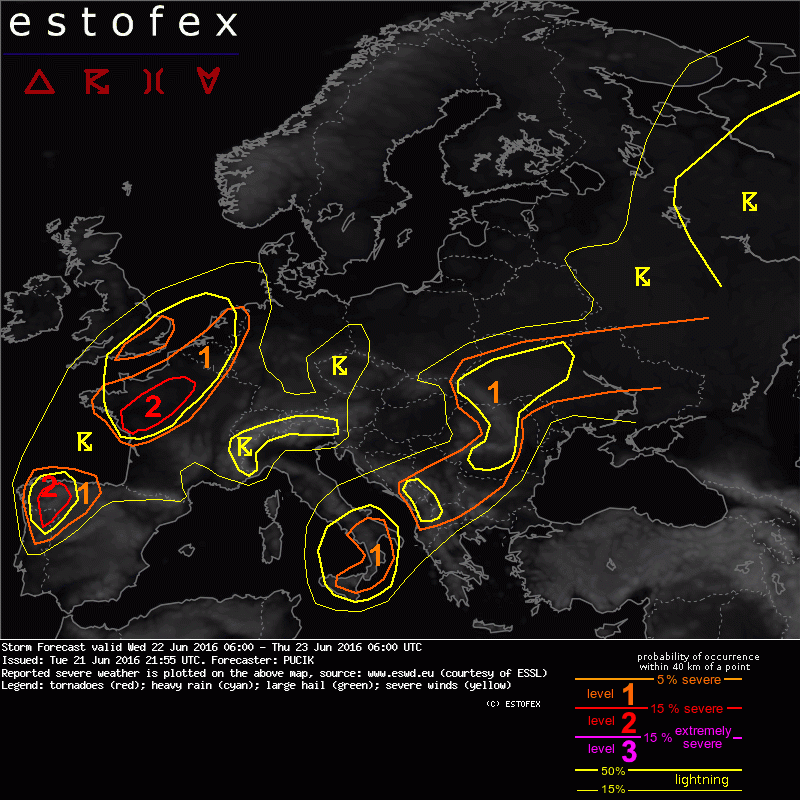
Storm Forecast valid: Wed 22 Jun 2016 06:00 to Thu 23 Jun 2016 06:00UTC
22-06-2016 23:55 - Estofex - Relevant 22-06-2016/23-06-2016