15/09/2025 (niet ingelogd)

Weer in het nieuws

Filter

<<<94/120>>>

Storm Forecast valid: Sun 05 Jun 2016 06:00 to Mon 06 Jun 2016 06:00UTC
04-06-2016 18:39 - Estofex | m.b.t. 05-06-2016 t/m 06-06-2016
A level 2 was issued for W-Germany, NE-France, S-Belgium and Luxembourg mainly for isolated large hail, severe wind gusts and heavy/excessive rain. A level 1 surrounds the level 2 and covers most parts of SE and parts of CNTRL-/E-Europe mainly for isolated excessive rainfall amounts and isolated large hail/severe wind gusts.
Onweersbuien op 2 juni 2016
03-06-2016 12:00 - KNMI | m.b.t. 02-06-2016
Wateroverlast in Boxmeer.
Storm Forecast valid: Fri 03 Jun 2016 06:00 to Sat 04 Jun 2016 06:00UTC
02-06-2016 12:00 - Estofex | m.b.t. 03-06-2016 t/m 04-06-2016
A level 1 was issued from Romania to Benelux mainly for isolated large hail, excessive rain and a severe wind gust or two.
Lange periode van onweersbuien door onstabiele lucht
02-06-2016 12:00 - KNMI | m.b.t. 25-05-2016 t/m 07-06-2016
Al sinds vrijdag 25 mei stroomt er warme, vochtige en onstabiele lucht over Nederland die wordt aangevoerd over de noordflank van een lagedrukgebied dat boven Europa rondtolt. Dat zorgt de afgelopen week bijna elke dag voor steeds nieuwe onweersbuien met hevige regenval, bliksem en hagel.
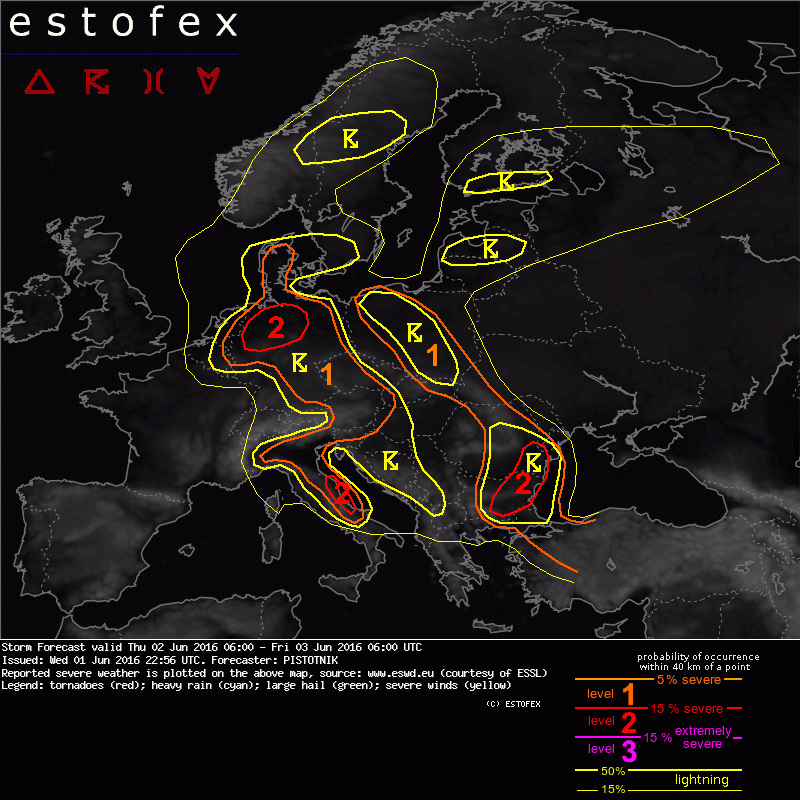
Storm Forecast valid: Thu 02 Jun 2016 06:00 to Fri 03 Jun 2016 06:00UTC
01-06-2016 22:56 - Estofex | m.b.t. 02-06-2016 t/m 03-06-2016
A level 2 is issued for N Germany mainly for excessive convective precipitation and to a lesser extent for large hail and severe convective wind gusts.
A level 1 is issued for parts of Italy, Austria, Germany, Denmark, the Czech Republic, Slovakia, Poland, the SW Ukraine and N Romania mainly for excessive convective precipitation.
Onweersbuien op 30 mei 2016
01-06-2016 12:00 - KNMI | m.b.t. 30-05-2016
Zware buien veroorzaakten veel overlast en schade.
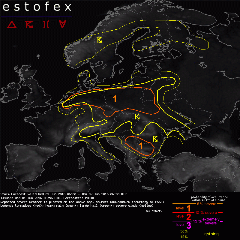
Storm Forecast valid: Wed 01 Jun 2016 06:00 to Thu 02 Jun 2016 06:00UTC
01-06-2016 06:56 - Estofex | m.b.t. 01-06-2016 t/m 02-06-2016
A level 1 was issued for eastern BENELUX through northern Germany, central Czech Republic and eastern Poland mainly for excessive precipitation
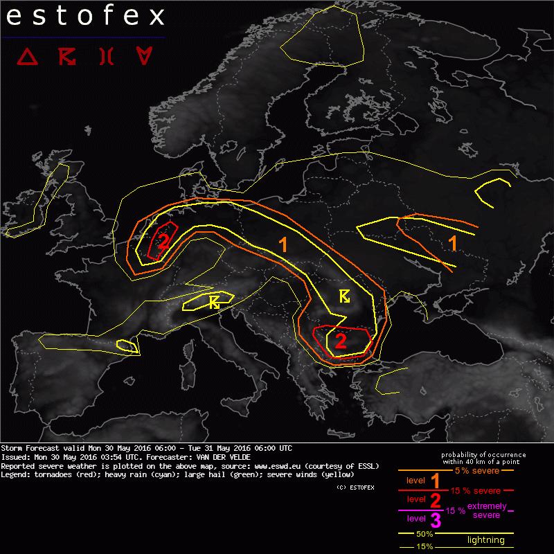
Storm Forecast valid: Mon 30 May 2016 06:00 to Tue 31 May 2016 06:00UTC
30-05-2016 03:54 - Estofex | m.b.t. 30-05-2016 t/m 31-05-2016
A level 2 was issued for Netherlands, Belgium and W Germany mainly for excessive convective precipitation. A level 1 was issued for N Germany, Poland mainly for isolated large hail and excessive convective precipitation.
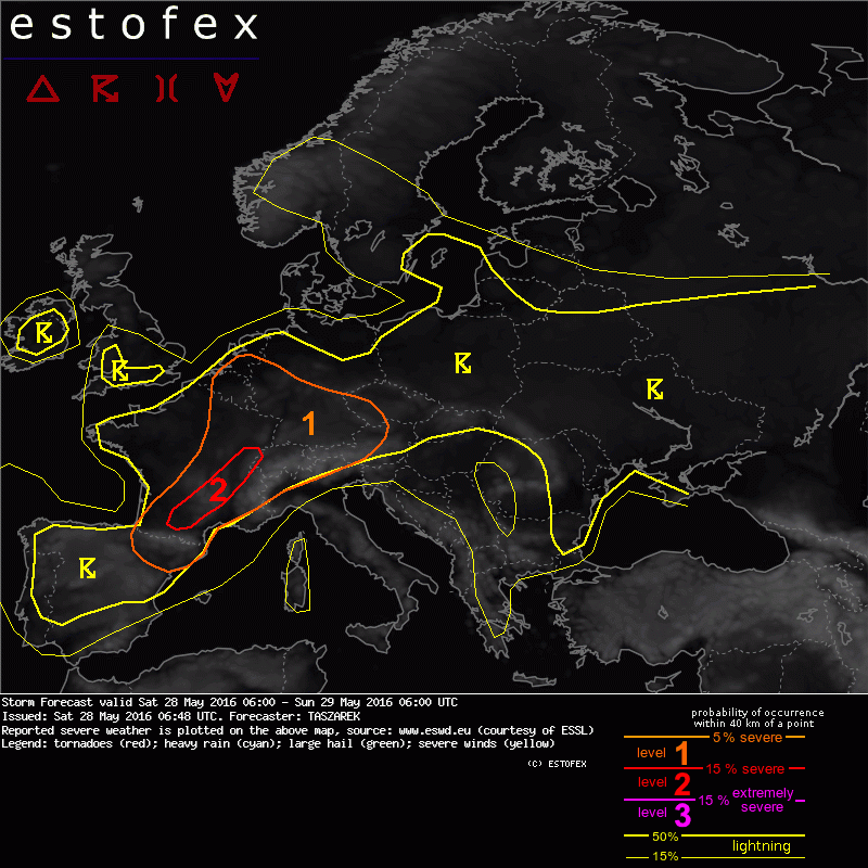
Storm Forecast valid: Sat 28 May 2016 06:00 to Sun 29 May 2016 06:00UTC
28-05-2016 06:48 - Estofex | m.b.t. 28-05-2016 t/m 29-05-2016
A level 1 was issued for part of W and CNTRL Europe mainly for large hail, severe wind gusts and in lesser extent for excessive precipitation.
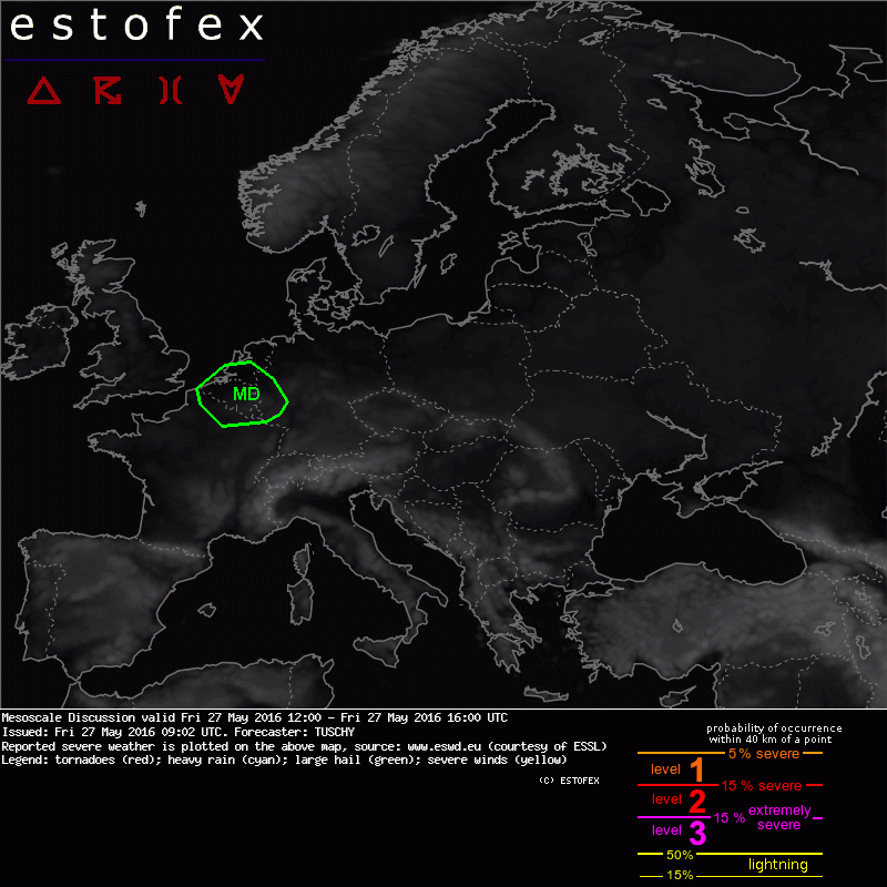
Mesoscale Discussion valid: Fri 27 May 2016 12:00 to Fri 27 May 2016 16:
27-05-2016 09:02 - Estofex | m.b.t. 27-05-2016
This mesoscale discussion was issued to reflect a level-1 upgrade over Belgium/NE France.
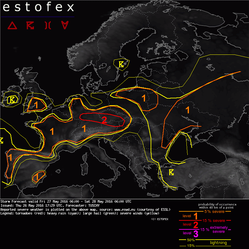
Storm Forecast Valid: Fri 27 May 2016 06:00 to Sat 28 May 2016 06:00UTC
26-05-2016 17:29 - Estofex | m.b.t. 27-05-2016 t/m 28-05-2016
A level 2 was issued for parts of CNTRL Germany, S-Czech Republic and E-Austria mainly for a few discrete supercells with large/very large hail, severe wind gusts, heavy rain and an isolated tornado event. A level 1 surrounds the level 2 mainly for large hail and severe wind gusts next to locally excessive rain.
NL Skywarners actief in de Alley!
22-05-2016 09:59 - Hans Stans | m.b.t. 22-05-2016

<<<94/120>>>