
windhoos Ternaard 06-08-2011
06-08-2011 23:00 - YouTube - Relevant 06-08-2011

Extreme neerslagsom in Herwijnen
30-06-2011 00:00 - KNMI - Relevant 28-06-2011
Storm Forecast valid Tue 28 Jun 2011 06:00 to Wed 29 Jun 2011 06:00UTC
27-06-2011 12:00 - Estofex - Relevant 28-06-2011/29-06-2011

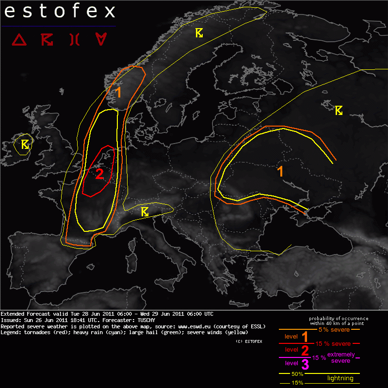
Extended Forecast Valid Tue 28 Jun 2011 06:00 to Wed 29 Jun 2011 06:00U
26-06-2011 18:41 - Estofex - Relevant 28-06-2011/29-06-2011
Topic Verwachtingen 27/28 juni 2011
24-06-2011 12:00 - Skywarn NL forum - Relevant 27-06-2011/28-06-2011
19-05-2009 - Op weg langs de Maas
13-02-2011 16:03 - Hans' Weerweb - Relevant 19-05-2009

Het noodweer van 14 juli 2010
19-12-2010 12:00 - KNMI - Relevant 14-07-2010
Beeldenbank: Waterhoos
08-08-2010 22:00 - Skywarn NL waarnemer - Relevant 08-08-2010

Meerdere funnels en waterhoos IJ- en Markermeer
08-08-2010 20:11 - Weerwoord - Relevant 08-08-2010
KNMI: Vooral valwinden bij noodweer 14 juli
21-07-2010 12:00 - KNMI - Relevant 14-07-2010
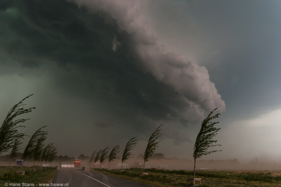
Foto passage shelfcloud omg. Boxmeer
15-07-2010 12:00 - Skywarn NL waarnemer - Relevant 14-07-2010
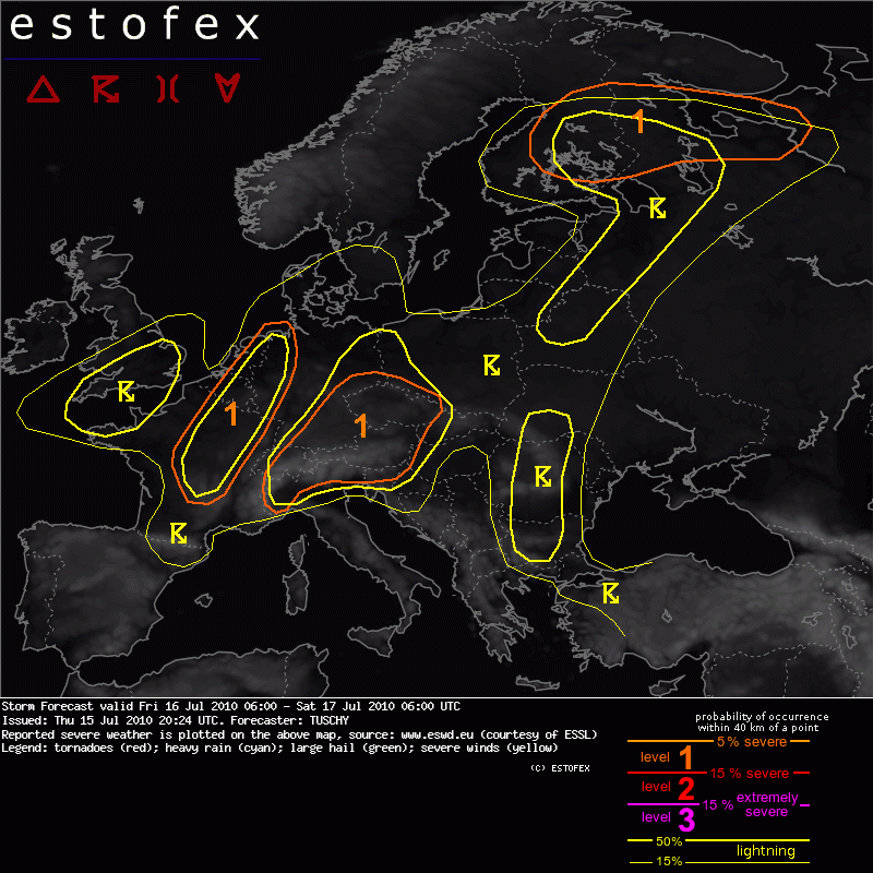
Storm Forecast valid Fri 16 Jul 2010 06:00 to Sat 17 Jul 2010 06:00UTC
15-07-2010 12:00 - Estofex - Relevant 16-07-2010/17-07-2010
Storm Forecast valid: Wed 14 Jul 2010 06:00 to Thu 15 Jul 2010 06:00UTC
13-07-2010 22:54 - Estofex - Relevant 14-07-2010/15-07-2010
.png)
Noodweer Achterhoek 12-07-2010
12-07-2010 12:00 - YouTube - Relevant 12-07-2010

Guidance per 07:15lt
12-07-2010 07:16 - KNMI - Relevant 12-07-2010
Beelden schade door valwinden 10/7
11-07-2010 00:00 - Skywarn NL waarnemer - Relevant 10-07-2010/11-07-2010

Storm Forecast valid: Sat 10 Jul 2010 06:00 to Sun 11 Jul 2010 06:00UTC
10-07-2010 06:27 - Estofex - Relevant 10-07-2010/11-07-2010

Nieuw Weeralarm waarschuwt doeltreffender voor zeer extreem weer
21-12-2009 11:00 - KNMI - Relevant 21-12-2009
21/07/09 - Superdag met een clash of titans!
30-07-2009 12:00 - Hans' Weerweb - Relevant 21-07-2009

Meteoconsult over Dalfsen
30-07-2009 12:00 - Weerwoord - Relevant 30-07-2009