
Foto's funnelcloud gezien vanuit Harlingen
25-04-2016 18:00 - Facebook - Relevant 25-04-2016
Interactie tussen twee hoosjes
25-04-2016 18:00 - Facebook - Relevant 25-04-2016
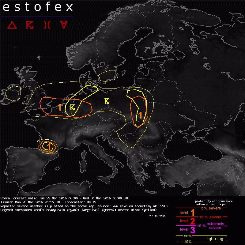
Storm Forecast valid: Tue 29 Mar 2016 06:00 to Wed 30 Mar 2016 06:00UTC
28-03-2016 20:15 - Estofex - Relevant 29-03-2016/30-03-2016
Storm Forecast valid: Mon 28 Mar 2016 06:00 to Tue 29 Mar 2016 06:00UTC
28-03-2016 03:11 - Estofex - Relevant 28-03-2016/29-03-2016
.png)
Verzameling informatie over buien van 30 augustus
24-03-2016 22:36 - Weerwoord - Relevant 30-08-2015/31-08-2015
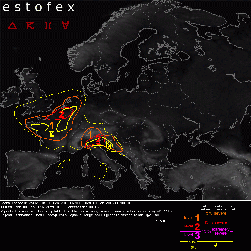
Storm Forecast valid Tue 09 Feb 2016 06:00 to Wed 10 Feb 2016 06:00UTC
08-02-2016 21:58 - Estofex - Relevant 09-02-2016/10-02-2016
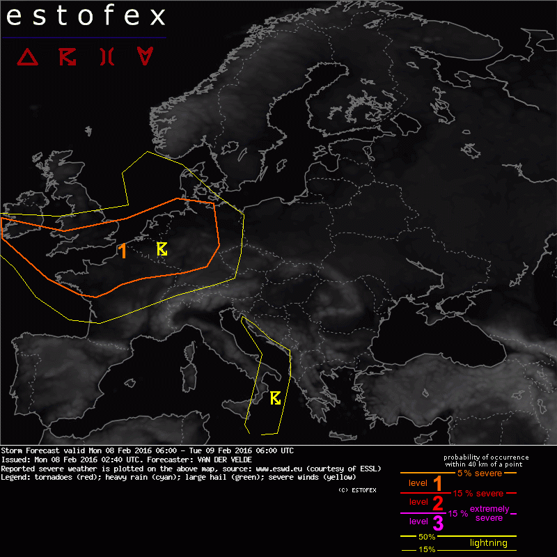
Storm Forecast valid: Mon 08 Feb 2016 06:00 to Tue 09 Feb 2016 06:00UTC
08-02-2016 02:40 - Estofex - Relevant 08-02-2016/09-02-2016
KNMI: IJzel begin januari 2016
08-01-2016 13:00 - KNMI - Relevant 03-01-2016/06-01-2016
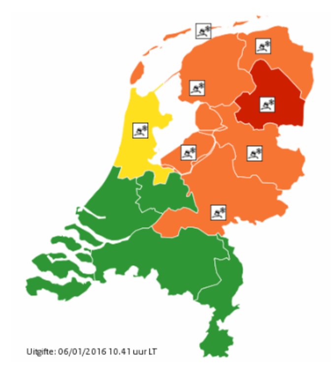
Langdurige ijzel bijzonder maar niet uniek
08-01-2016 12:00 - KNMI - Relevant 03-01-2016/07-01-2016
Einde ijzelperiode in zicht
07-01-2016 12:00 - KNMI - Relevant 07-01-2016
Enkele ijzel Twitterfoto's
03-01-2016 10:42 - Weerwoord - Relevant 03-01-2016
2015-12-05/06: Veel wind NW en Wadden
05-12-2015 12:46 - Skywarn NL forum - Relevant 05-12-2015/06-12-2015
Actueel in de US: Skywarn Recognition Day! :-)
05-12-2015 11:38 - Redactie - Relevant 05-12-2015
Achtergrond zeer zware windstoten 29 november 2015
30-11-2015 12:00 - KNMI - Relevant 29-11-2015
KNMI: Achtergrond onweer 30-31 augustus 2015
30-11-2015 12:00 - KNMI - Relevant 30-08-2015/31-08-2015
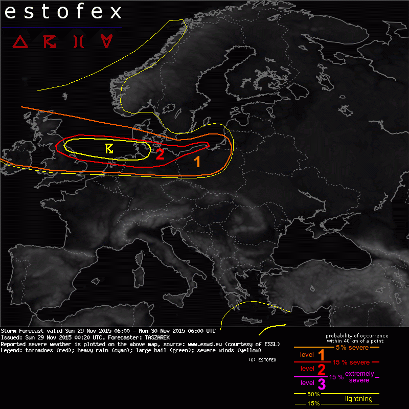
Storm Forecast valid: Sun 29 Nov 2015 06:00 to Mon 30 Nov 2015 06:00UTC
29-11-2015 00:20 - Estofex - Relevant 29-11-2015/30-11-2015
2015-11-28 Kans zware windstoten kustgebieden
28-11-2015 00:00 - Skywarn NL forum - Relevant 28-11-2015
2015-11-17/18 Storm en (zeer) zware windstoten
17-11-2015 00:00 - Skywarn NL forum - Relevant 17-11-2015/18-11-2015
Storm Forecast valid: Tue 17 Nov 2015 06:00 to Wed 18 Nov 2015 06:00UTC
16-11-2015 22:35 - Estofex - Relevant 17-11-2015/18-11-2015

2015-11-13 Na frontpassage windstoten en (pittige) buien
13-11-2015 12:00 - Skywarn NL forum - Relevant 13-11-2015