
Guidance en weerkaartjes per 12:00lt
07-08-2018 00:00 - KNMI - Relevant 07-08-2018

Storm Forecast Valid: Tue 07 Aug 2018 06:00 to Wed 08 Aug 2018 06:00 UTC
06-08-2018 19:54 - Estofex - Relevant 07-08-2018/08-08-2018

Meer water bestemd voor terugdringen verzilting; Bernardsluizen bij Tiel gestrem
06-08-2018 12:00 - Rijkswaterstaat - Relevant 06-08-2018
Zeldzaam warme nachten
03-08-2018 12:00 - KNMI - Relevant 03-08-2018
Droogte in Nederland vraagt om verdeling water
02-08-2018 12:50 - Rijksoverheid - Relevant 02-08-2018
Code Geel i.v.m. aanhoudende hitte
02-08-2018 11:00 - Redactie - Relevant 02-08-2018

Guidance en weerkaartjes per 13:00lt
31-07-2018 13:00 - KNMI - Relevant 31-07-2018/01-08-2018

Recorddroge juli met buitengewoon veel zon
31-07-2018 12:00 - KNMI - Relevant 31-07-2018
Gevaar van hitte
31-07-2018 12:00 - KNMI - Relevant 31-07-2018
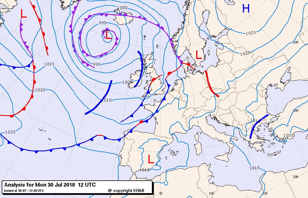
Guidance en weerkaartjes per 13:00lt
30-07-2018 13:00 - KNMI - Relevant 30-07-2018/31-07-2018
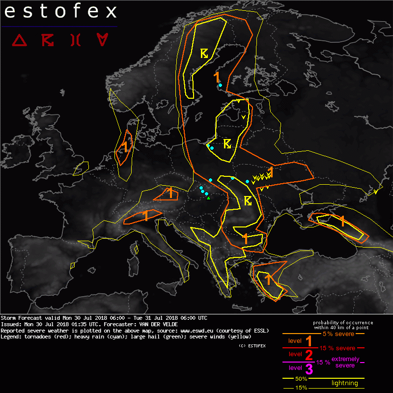
Storm Forecast Valid: Mon 30 Jul 2018 06:00 to Tue 31 Jul 2018 06:00 UTC
30-07-2018 01:35 - Estofex - Relevant 30-07-2018/31-07-2018
Geen nieuw temperatuurrecord
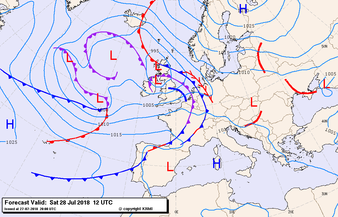
28-07-2018 12:00 - Redactie - Relevant 27-07-2018

Guidance en weerkaartjes per 08:00lt
28-07-2018 08:00 - KNMI - Relevant 28-07-2018/29-07-2018
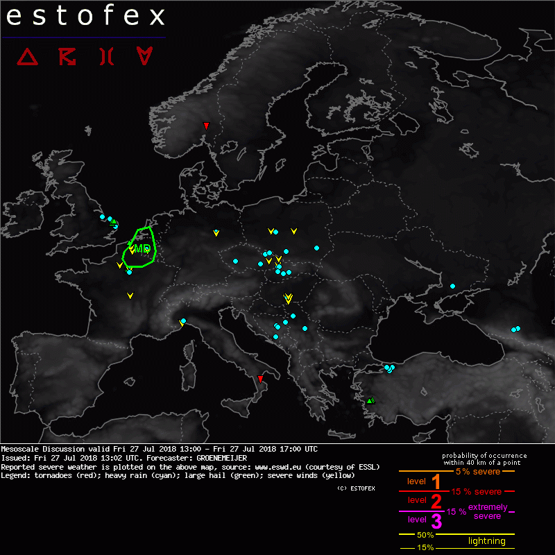
Mesoscale Discussion Valid: Fri 27 Jul 2018 13:00 to Fri 27 Jul 2018 17:00 UTC
27-07-2018 13:02 - Estofex - Relevant 27-07-2018
Maatregelen tegen toenemende verzilting Amsterdam-Rijnkanaal
27-07-2018 09:32 - Rijksoverheid - Relevant 27-07-2018
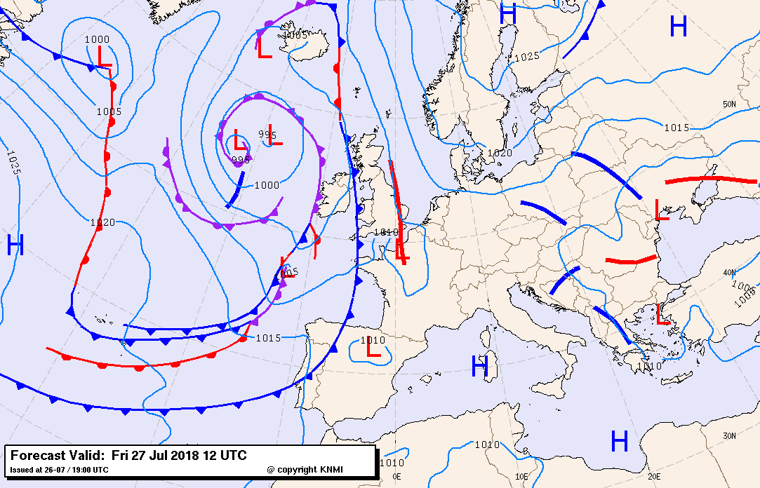
Guidance en weerkaartjes per 08:00lt
27-07-2018 08:00 - KNMI - Relevant 27-07-2018/28-07-2018
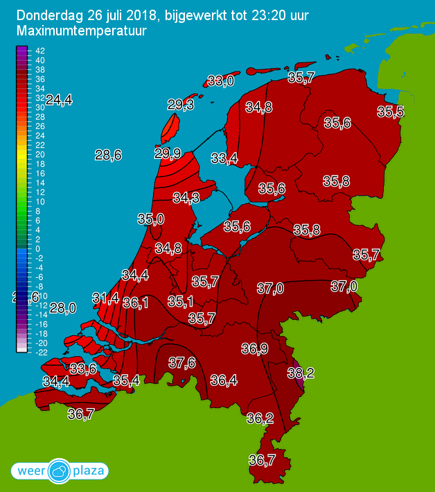
Over afgelopen dag ...
27-07-2018 00:50 - Redactie - Relevant 26-07-2018
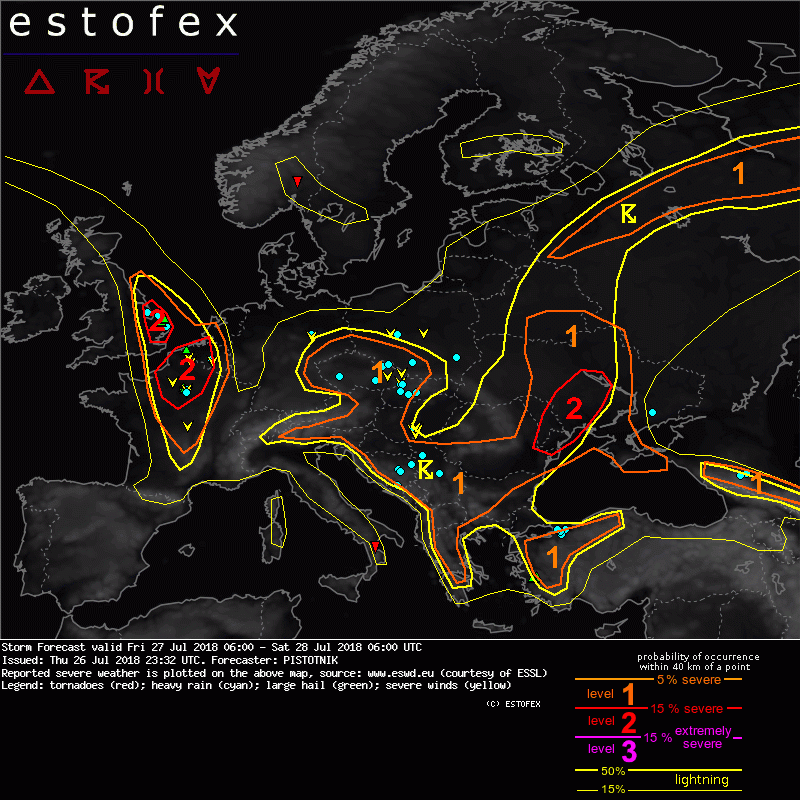
Storm Forecast Valid: Fri 27 Jul 2018 06:00 to Sat 28 Jul 2018 06:00 UTC
26-07-2018 23:32 - Estofex - Relevant 27-07-2018/28-07-2018
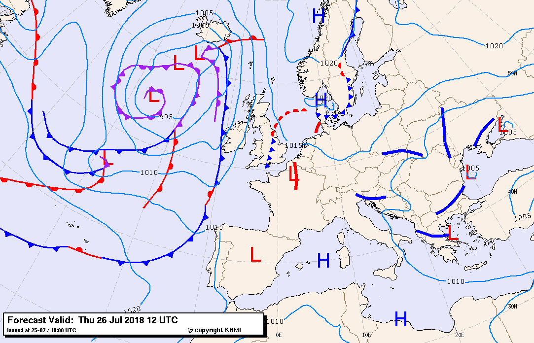
Guidance en weerkaartjes per 08:00lt
26-07-2018 08:00 - KNMI - Relevant 26-07-2018/27-07-2018
Droogtemonitor: Het blijft droog, waterbeheerders nemen maatregelen
25-07-2018 19:47 - Rijksoverheid - Relevant 25-07-2018