
26-07-2008 13:19 | Estofex | m.b.t. 26-07-2008 t/m 27-07-2008
Forecast Update
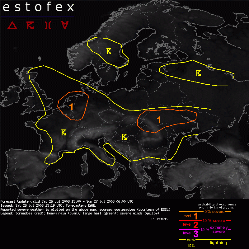
Valid: Sat 26 Jul 2008 13:00 to Sun 27 Jul 2008 06:00 UTC
Issued: Sat 26 Jul 2008 13:19
Forecaster: DAHL
SYNOPSIS
Refer to convective forecast from 25 July 2008.
DISCUSSION
... NW Germany ... Benelux countries ...
12Z ascents from western Germany indicate 2000 J/kg MLCAPE, with DLS on the order of 10 to 12.5 m/s, which is more than anticipated earlier. MM5 suggests that shear should be strongest over NW Germany and Benelux which is also where thermodynamic fields happen to be strongest. Expect at least briefly organized, mainly multicellular storms capable of large hail and severe wind gusts. Isolated mesocyclones may also occur, locally augmenting the hail threat. Storms should gradually diminish after sundown.
Verwachtingen/waarschuwingen
