
29-06-2022 22:43 | Estofex | m.b.t. 30-06-2022 t/m 01-07-2022
Storm Forecast
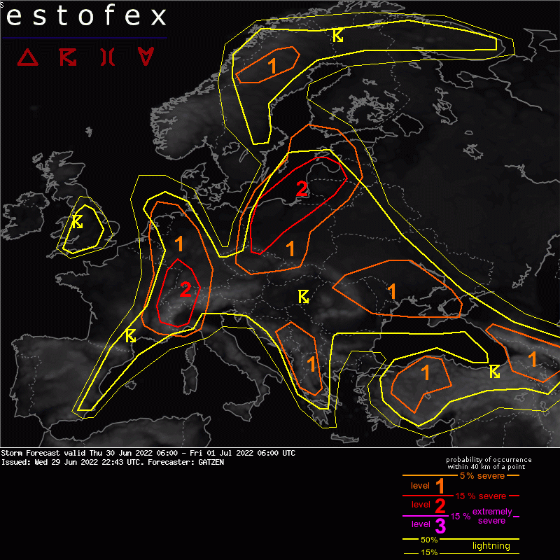
Valid: Thu 30 Jun 2022 06:00 to Fri 01 Jul 2022 06:00 UTC
Issued: Wed 29 Jun 2022 22:43
Forecaster: GATZEN
A level 1 was issued across western Germany, Benelux, eastern France, north-western Italy far heavy rain, severe wind gusts, and large hail.
SYNOPSIS
The west European trough is placed across the British Isles. With a south-westerly flow, mid-level vortices lift across western and central Europe. Associated with an intense short-wave trough, a cold front crosses France and enters Germany during the day. Farther east, subtle mid-level flow prevails with a low-level moist air mass.
DISCUSSION
Western Germany, Benelux, eastern France, western Alps, north-western Italy
Ahead of the approaching cold front, a warm and moist air mass is advected north. Widespread initiation is expected along the front, with most activity expected over the western Alps and south-western Germany, where CAPE is highest. Vertical wind shear is sufficient for well-developed multicells, that move along the cold front and are expected to cluster and form a squall line. Supercells are also not ruled out along the level 2 area due to an increasing mid-level jet that ejects from the upstream trough axis.
(alleen de voor NL en direct aangrenzende gebieden relevante tekstdelen overgenomen, klik hier voor de volledige forecast, red.)
Hagel(-schade) | Verwachtingen/waarschuwingen | Wateroverlast/(zware) neerslag | Wind/storm (-schade)
