
17-06-2022 23:40 | Estofex | m.b.t. 18-06-2022 t/m 19-06-2022
Storm Forecast
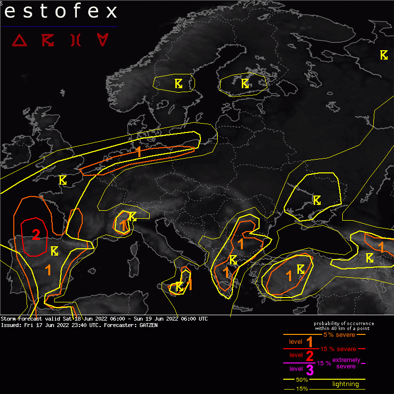
Valid: Sat 18 Jun 2022 06:00 to Sun 19 Jun 2022 06:00 UTC
Issued: Fri 17 Jun 2022 23:40
Forecaster: GATZEN
A level 1 was issued for the Channel, northern Netherlands, northern Germany, north-western Poland for large hail and severe wind gusts.
SYNOPSIS
Mid-level flow features a west-European ridge flanked by a broad trough across eastern Europe and cut-off trough west of Iberia. This blocking has reached its maximum intensity as a north-east-Atlantic trough moves towards Scandinavia and leads to a temporary more progressive mid-level flow. At low levels, hot air across Spain and France will advect east into central Europe, framed by an intense frontal zone that slowly advances east and south.
DISCUSSION
South-eastern England, northern France, northern Netherlands, northern Germany, north-western Poland
Along the frontal boundary across the southern North Sea and Baltic Sea, storm development is loimited initially in a dry and strongly sheared environment. However, with increasing mid-level vorticity advection ahead of a vort-max ejecting from the Atlantic trough, a frontal wave is expected with warm air advection spreading east. Elevated storms are forecast to spread east during the night. Despite strongy capped low-level air, strong vertical wind hsear also above the boundary layer will support well-organized storms capable of producing large hail and severe wind gusts. The lack of moisture will limit a larger system at this time.
(Alleen de voor NL en direct aangrenzende gebieden relevante tekstdelen overgenomen, klik hier voor de volledige forecast, red.)
Hagel(-schade) | Verwachtingen/waarschuwingen | Wind/storm (-schade)
