
08-09-2021 22:21 | Estofex | m.b.t. 09-09-2021 t/m 10-09-2021
Storm Forecast
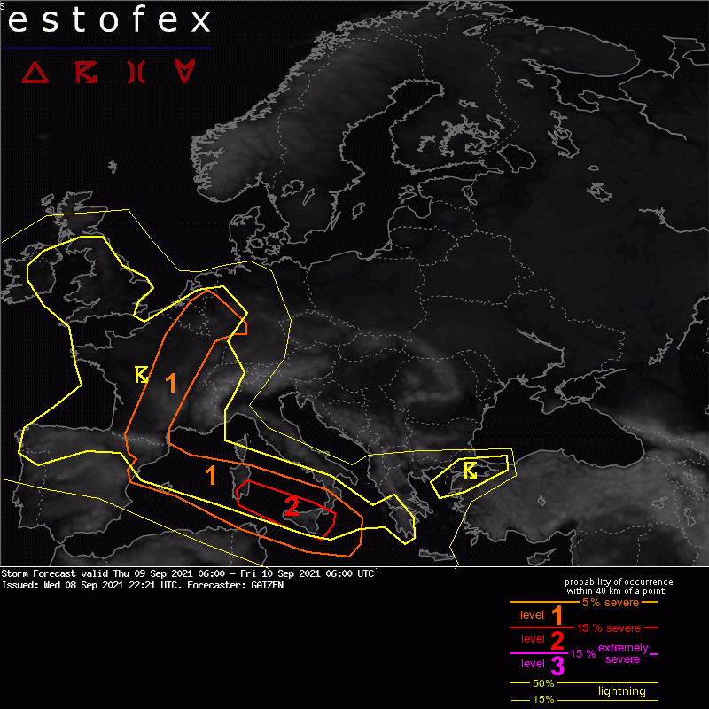
Valid: Thu 09 Sep 2021 06:00 to Fri 10 Sep 2021 06:00 UTC
Issued: Wed 08 Sep 2021 22:21
Forecaster: GATZEN
A level 2 was issued across the southern Tyrrhenian Sea for hail, wind gusts and extreme rainfall.
A level 1 was issued across western Europe into the Mediterranean for extreme rainfall.
SYNOPSIS
A blocking ridge across eastern Europe if flanked by low geopotential to the south-west, with a slowly progressing cut-off trough across the central Mediterranean and a slowly lifting mid-level trough across western Europe. A plume of warm air is present ahead of the western trough and a frontal boundary extends from the west Mediterranean to France and into the Benelux countries. Rich moisture is present along this boundary. Most of the forecast area, however, is dominated by dry low-level air masses, limiting chances of thunderstorms.
DISCUSSION
France into Benelux and Germany
In a weakly sheared, moist environment, storms are expected to form along the frontal boundary that slowly progresses eastward. A humid troposphere and a low cloud base with a large warm part of the storms will pose a threat of some extreme rainfall events with slow moving storms. The threat will later weaken across Germany.
(alleen de voor NL en direct aangrenzende gebieden relevante tekstdelen overgenomen, klik hier voor de volledige forecast, red.)
Verwachtingen/waarschuwingen | Wateroverlast/(zware) neerslag
