
11-03-2021 01:15 | Estofex | m.b.t. 11-03-2021 t/m 12-03-2021
Storm Forecast
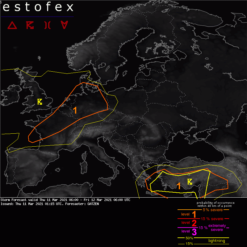
Valid: Thu 11 Mar 2021 06:00 to Fri 12 Mar 2021 06:00 UTC
Issued: Thu 11 Mar 2021 01:15
Forecaster: GATZEN
A level 1 was issued across southern Turkey into northern Syria and Iraq and across the Aegean Sea and north-east Mediterranean mainly for large hail and severe wind gusts.
A level 1 was issued across north-western France into the Benelux countries and northern and central Germany mainly for severe wind gusts.
DISCUSSION
A strong zonal jet expands across western Europe ahead of an intense Atlantic trough. Downstream, an east-European trough amplifies and diggs across the east Mediterranean. Ahead of this trough, a very strong mid-level jet affects the east Mediterranean. Cold and dry air masses are present across north-eastern Europe. Ridging affects the south-western portions.
DISCUSSION
France into Germany
An intense low pressure system will affect the area with strong to severe wind gusts. Some convective contribution to these gusts is expected. Main focus is the mid-level front that is associated with steep low- to mid-level lapse rates. These may even overlap with the cold front that crosses Germany during the day, so that pre-frontal moisture with dewpoints around 6°C can overlap with modest low-level lapse rates. Weak low-topped CAPE is not ruled out. In the wake of the cold front, further showers and thunderstorms are forecast in an slightly unstable environment.
Given very strong vertical wind shear already at low levels, thermodynamic profiles indicate a typical high-shear, low-CAPE environment. Showers and thunderstorms will have the potential to produce severe wind gusts, especially along bowing segments. Additonally, low-topped mesocyclones may produce tornadoes.
The main limiting factor is the rather weak cold pool potential and the weak low-level convergence indicated by latest models. A well-developed narrow cold-frontal rain band is not indicated by most models, but a broken line or isolated segments of convection. Overall contribution of convective storms to the severe wind gusts occurrence is forecast to be limited for this reason.
(alleen de voor NL en diurect aangrenzende gebieden relevant tekstdelen overgenomen, klik hier voor de volledige forecast, red.)
Verwachtingen/waarschuwingen | Wind/storm (-schade)
