
20-05-2020 23:16 | Estofex | m.b.t. 21-05-2020 t/m 22-05-2020
Storm Forecast
Valid: Thu 21 May 2020 06:00 to Fri 22 May 2020 06:00 UTC
Issued: Wed 20 May 2020 23:16
Forecaster: GATZEN
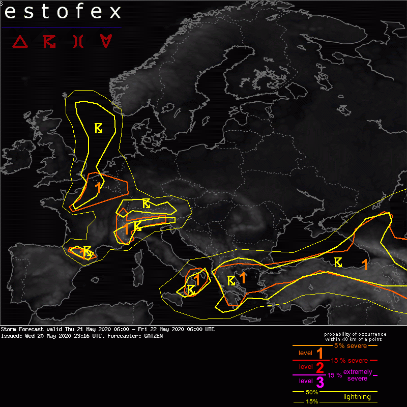
A level 1 was issued across southern and western Alps, Pyrenees, northern France and Belgium into Luxembourg and western Germany mainly for large hail and locally extreme rainfall.
SYNOPSIS
At the southern flank of a polar trough across eastern Europe, a well-developed vort-max travels eastward across south-eastern Europe. An unstable and strongly sheared air mass is located ahead of this vort-max, whereas moist and slightly unstable air is expected near the trough's base across Greece. Western Europe is affected by a plume of unstable air that advects into the North Sea ahead of a short-wave trough that crosses the British Isles in the morning.
DISCUSSION
Alps, Pyrenees, northern France
Although CAPE/shear values are marginal, some storms are forecast to produce large hail and excessive rain. In northern France, multicells are forecast, whereas isolated storms or clusters are forecast farther south.
(alleen de voor NL relevante tekstdelen zijn weergegeven, klik hier voor de volledige forecast, red.)
Verwachtingen/waarschuwingen | Wateroverlast/(zware) neerslag
