
11-05-2007 23:13 | Estofex | m.b.t. 11-05-2007 t/m 12-05-2007
Forecast Update
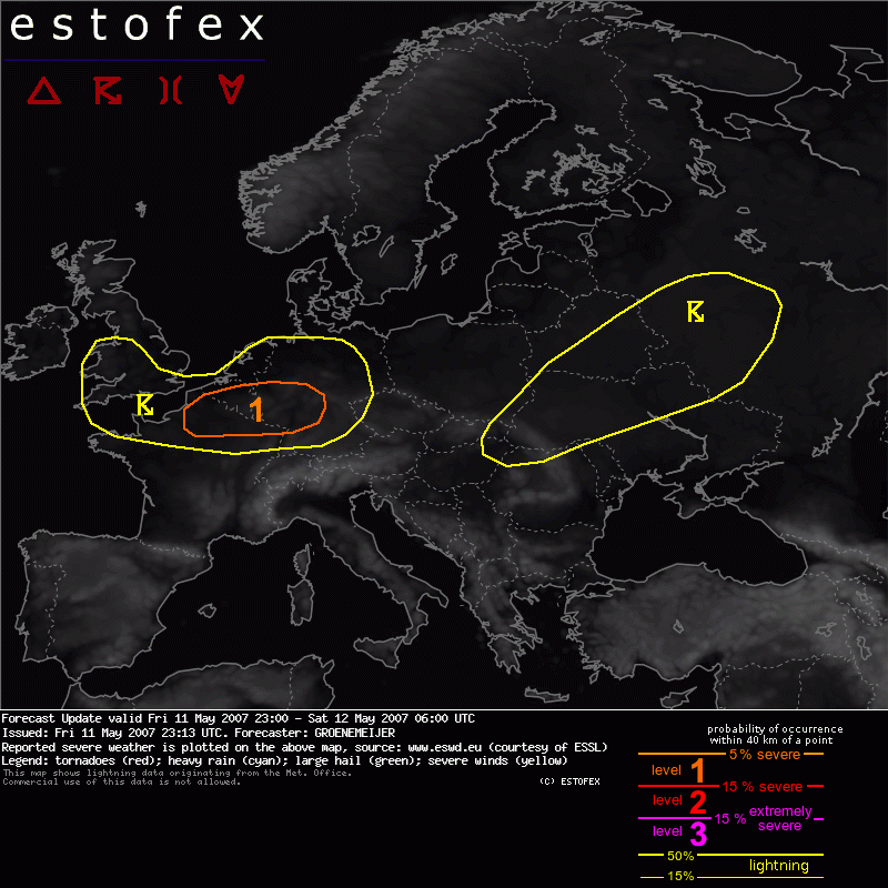
Valid: Fri 11 May 2007 23:00 to Sat 12 May 2007 06:00 UTC
Issued: Fri 11 May 2007 23:13
Forecaster: GROENEMEIJER
SYNOPSIS
refer to Convective Forecast
DISCUSSION
Belarus, Russia, Ukraine...
Activity over Belarus, Russia, Ukraine has become elevated and severe threat is becoming minimal now.
N France, S Benelux, Germany...
A baroclinic wave travels eastward over Belgium. In the wake of its warm front a 20-25 m/s kt westerly low-level jet is blowing. Very weak instability is forecast per numerical guidance, but strong upward vertical motion in the left-exit region of a 40 m/s jet at 500 hPa is proving sufficient for convective initiation over Northern France as of 23:00 UTC. As low-level shear is very strong - on the order of 15-20 m/s in the 0-1 km layer- and storm-relatve helicity is locally high as well, it is not ruled out that some cells will briefly become supercellular. Tornadoes cannot be ruled out. Small bowing segments may prove to be able to produce gusts in excess of the severe threshold of 25 m/s in some places. Because of all this, an upgrade for the affected region to level 1 appears warranted.
Tornado/hoosverschijnsel(en) | Verwachtingen/waarschuwingen | Wind/storm (-schade)
