
28-02-2007 04:16 | Estofex | m.b.t. 28-02-2007 t/m 01-03-2007
Storm Forecast
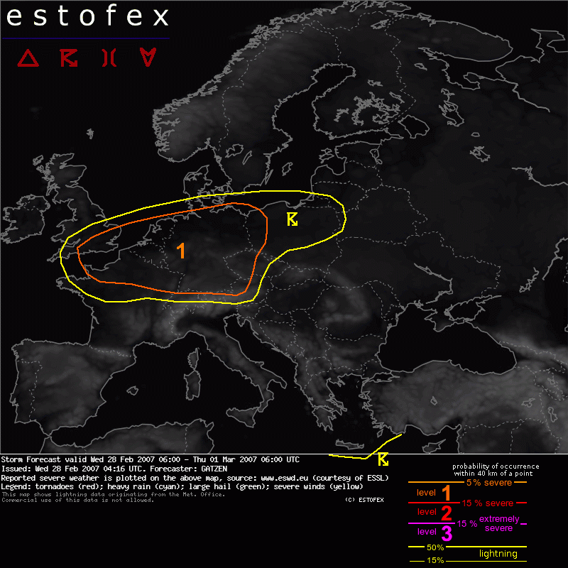
Valid: Wed 28 Feb 2007 06:00 to Thu 01 Mar 2007 06:00 UTC
Issued: Wed 28 Feb 2007 04:16
Forecaster: GATZEN
SYNOPSIS
Westerly jet at 500 hPa is directed towards France and Alpine region. To the north, a well-developed trough is present over British Isles. A short-wave trough is crossing Germany in the range of strong south-westerly flow at the eastern flank of this trough. Over Mediterranean, upper long-wave trough propagates eastward.
The Channel region, Benelux, northern Germany, western Poland
Propagating short-wave trough has reached southern British Isles at this time, and showers and thunderstorms have developed. Expect that air mass over North Sea region and Germany will be neutral to slightly unstable and profiles may look like latest Camborne sounding. Given rather steep low-level lapse rates and quite rich boundary-layer moisture, showers and thunderstorms will likely develop during the day underneath the trough axis. Given south-westerly surface winds and strong WSWerly winds above of the boundary-layer, strong LLS about 15 m/s is likely today, resulting in 150 J/kg 0-1 km SRH. Expect that showers and thunderstorms will organize into bowing lines and mesocyclones, most significant thread will be severe wind gusts. A few tornadoes are also not ruled out in regions will rich low-level moisture, where low-level buoyancy will be strongest. Thunderstorms will likely weaken during the evening over eastern Germany, but may also affect eastern Poland late in the day.
Southern Germany
Along the propagating cold front over southern Germany, strong low-level forcing is expected. Given neutral lapse rates and rich low-level moisture in the warm sector air mass, a convective line is not ruled out, capable of producing severe wind gusts and a few tornadoes in the afternoon hours. However, chance for severe weather seems to be lower than further north.
Verwachtingen/waarschuwingen | Wind/storm (-schade)
