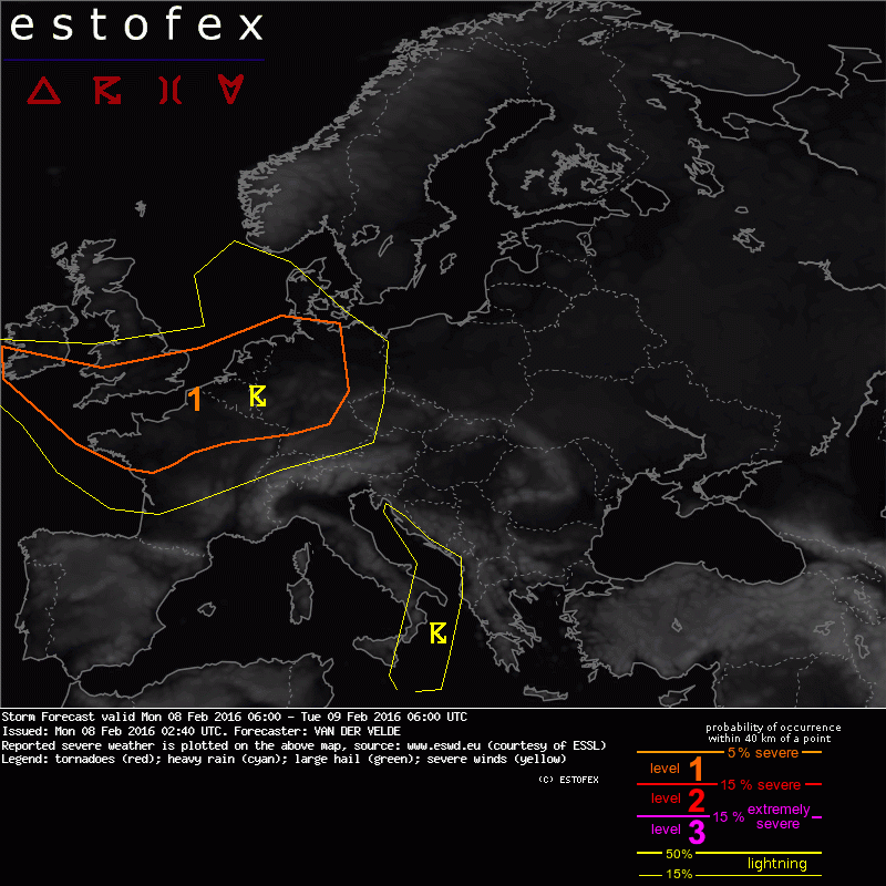
08-02-2016 02:40 | Estofex | m.b.t. 08-02-2016 t/m 09-02-2016

Storm Forecast
Valid: Mon 08 Feb 2016 06:00 to Tue 09 Feb 2016 06:00 UTC
Issued: Mon 08 Feb 2016 02:40
Forecaster: VAN DER VELDE
A level 1 was issued for parts of Ireland, France, Germany, UK, Belgium, Netherlands mainly for severe convective wind gusts.
SYNOPSIS / DISCUSSION
Cold unstable airmass associated with a low pressure system centered near the Shetland Islands is entering the European mainland at 06Z and brings convection with chances of thunder and severe wind gusts. The CAPE field is much overlapped by >25 m/s winds at 900 hPa througout the level 1 region. WRF models suggest the convection to be not so concentrated in lines as to cause a threat of widespread convective wind gusts, even though some bands of 500 hPa relative vorticity mark troughs, not clearly linked with low level convergence.
In addition, isolated tornadoes cannot be ruled out as 0-3 km SREH can be larger than 200 m²/s² although may not always be collocated with CAPE.
* This forecast was made without GFS convective maps (no recent data available for processing at ESTOFEX)
Verwachtingen/waarschuwingen | Wind/storm (-schade)