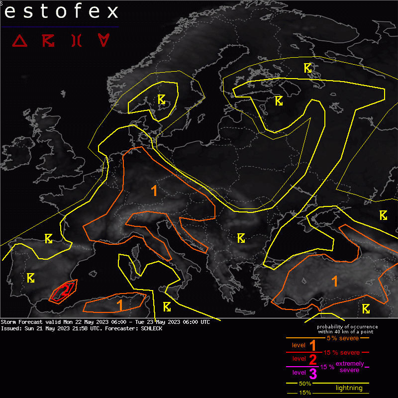
21-05-2023 21:58 | Estofex | m.b.t. 22-05-2023 t/m 23-05-2023

Storm Forecast
Valid: Mon 22 May 2023 06:00 to Tue 23 May 2023 06:00 UTC
Issued: Sun 21 May 2023 21:58
Forecaster: SCHLECK
Large area of Central Europe: Level 1
An upper ridge extends from the northern Bay of Biscay to Slovakia and edges slowly southwards during this time. At upper levels there is a reasonable westerly flow to the north of the ridge (Netherlands and northern Germany).
Active afternoon thunderstorms are likely to develop across much of this area by day, then decaying in the evening. In this region, fairly fat MLCAPE is abundant, reaching between 500-1000 J/Kg, with a 1-2 KM deep Effective Inflow Layer. However, vertical wind shear is often limited to 5-10ms. As such much of the convection is expected to be of a single cell mode. However, given the high CAPE updraught strength is likely to be sufficient to support some large hail >2cm diameter. It varies markedly across the region but some areas see inverted “V†type profiles suggesting an isolated strong wind gust remains probable.
Across the far north of this region in the extreme northeast of the Netherlands and northwestern Germany, there is a small region where the fairly fat and abundant MLCAPE, and reasonable vertical windshear overlaps. Here conditions are similar to further south, with the exception of the EBWD locally reaching 15ms. As such here there is the reasonable chance that some of the convection will be of a supercell nature, with straight hodographs favouring left and right splits.
In association with any such supercells 2-4cm diameter hail is possible, as well as strong wind gusts. Although limited wind shear in the lowest 500-1000M means that the risk of mesocyclonic tornadoes in this area remains very low.
(alleen de voor NL en direct aangrenzende gebieden relevante tekstdelen overgenomen, klik hier voor de volledige forecast, red.)
Hagel(-schade) | Verwachtingen/waarschuwingen | Wind/storm (-schade)